









A service from the
FAMILY HISTORY FEDERATION
www.familyhistoryfederation.com
www.parishchest.com
www.fhf-reallyuseful.com
Categories
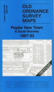
Poplar New Town & South Bromley 1867-93
Supplier:
Alan Godfrey Maps
London Large Scale Sheet 08.61 Poplar New Town & South Bromley 1867-93 - published 2026. Intro by Pamela Taylor.
This very detailed map is split between Poplar and Bromley, with coverage running from Guildford Road southward to East India Dock Road.
Features include St Mary & St Joseph's RC Chapel, Monastery House, Sailors' Home, North London Railway with Poplar station, St Michael & All Angels church and schools, St Saviour's Church, St Stephen's Church, schools and many streets of terraced housing.
On the reverse we include the 1893 map together with a specially written introduction.
The map links up with sheet 8.51 Bromley Limehouse Cut to the north, 7.70 Limehouse Cut to the west.
RRP: £3.75
© 2026 The Federation of Family History Societies Services Ltd
Website by Beachshore