









A service from the
FAMILY HISTORY FEDERATION
www.familyhistoryfederation.com
www.parishchest.com
www.fhf-reallyuseful.com
Categories
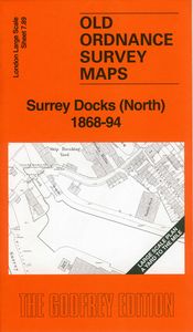
Surrey Docks (North) 1868-94
Supplier:
Alan Godfrey Maps
London Large Scale Sheet 07.89 Surrey Docks (South) 1868-94 - published 2026. Intro by Alan Godfrey.
This very detailed map covers the northern half of Surrey Docks.
Features include Stave Dock, Island Dock, Main Dock, Russia Dock, Globe Pond, Lavender Pond, Acorn Dock, Surrey Commercial Gasworks, Surrey Lock and nearby streets.
On the reverse we include the 1894 map, showing the same area at a later stage. We also include an introduction to the history of the area.
The map links up with sheet 07.88 Rotherhithe & Wapping to the west, 07.99 Surrey Docks South to the south.
RRP: £3.75
© 2026 The Federation of Family History Societies Services Ltd
Website by Beachshore